Home

Menu

Skip to content
  • About the Workshop
  • schedule
  • participants
  • resources
  • @moscowborders
  • » photos
  • » videos

Invisible Borders

Mapping Social Boundaries and Spatial Practices in the City

Day 6: Mapping Slavyanskiy Mir

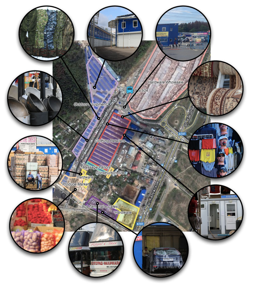
As part of our collaborative investigation of Slavyanskiy Mir on the 9th, we’re creating a map of the market and starting a Slavyanskiy Mir page on Wikipedia.

July 10, 2013 Christo de Klerk Posted in moscow Tagged Borders, Markets, Moscow, Retail, Slavyanskiy Mir, Wholesale Post Permalink

Post navigation

← Day 5: Understanding Slavyanskiy Mir
Typology of Borders in Slavyanskiy Mir →

Recent Posts

  • Mapping and Games: Experimental Participatory Research
  • Body, Borders, & the City
  • Bodies Under the Bridge
  • Invisible Borders: Presentation + Performance
  • Research Simulator: The Kremlin’s Invisible Borders

Recent Comments

No comments to show.

Archives

  • September 2013
  • July 2013
  • June 2013

Categories

  • berlin
  • future
  • invisible city
  • istanbul
  • jerusalem
  • moscow
  • new york city
  • russia
  • são paulo
  • uganda
© 2025 Invisible Borders.
Powered by WordPress. Theme Emphaino.
Go to mobile version