Maps are power projections. Adminsitrative jurisdiction and lines divide responsibilities for a space. But these lines made on paper force social processes into play with consequences in real space. Planning maps, as such, can be thought of as tools of violence, destruction and exclusion for their impact.
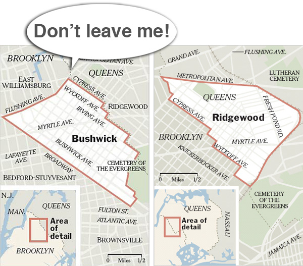
Take for instance the border of Queens and Brooklyn. If you walk through the neighborhood of Bushwick Brooklyn, it is warehouses, graffiti and young hipsters with cafes, bars and lounges. But as soon as you cross the road and enter Queens, it is visible in the urban environment. You can see the delinieations in the pavements and how they are maintained. But interestingly, the dividing road is an interesting border space which is unmaintained. In Ridgewood Queens, the neighborhood homes have front lawns, the homes, the mixed populations. Even though almost the same metro stations serve both populations, the experience of the same spaces by people in each neighborhood is quite different.
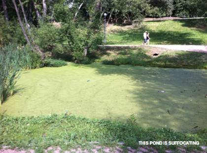
Last year, In Moscow’s district of Yuzhnoe Medvedkovo we discovered a eutrophicized pond, a neglected space which seemed out of place in an otherwise nicely maintained park. Looking on the map, we found that it was located on a district boundary and a site of contentious responsibility. Or lack there of.
The invisible ‘violence’ of these planning maps is evidenced in Jerusalem’s religious quarters and how plans for the future city completely omit existing city quarters. How do we experience these borderlines, drawn onto maps but unseen in real life? What urban interventions can challenge and blur these boundaries?